Orange Alert Issued for Chennai: Up to 20 cm Rain Expected Oct 21‑24
When Regional Meteorological Centre (RMC) Chennai sounded the orange alert on Tuesday, October 21, 2025, residents across Tamil Nadu braced for what could be the wettest stretch of the northeast monsoon season.
The warning, released at 1300 hrs IST, covers a swath of districts from Chennai to Ramanathapuram, with the India Meteorological Department predicting up to 20 cm of rain in just 24 hours for the hardest‑hit areas.
What the Orange Alert Means
Under the Orange Weather Alert (Oct 21‑24, 2025)Southeast Bay of Bengal, authorities expect "heavy to very heavy" rainfall – technically 6 cm to 20 cm in a single day. That level of precipitation can swamp low‑lying neighborhoods, block arterial roads, and overwhelm storm‑water drains.
“We’ve seen similar patterns during past monsoon peaks, but the convergence this time is unusually rapid,” said Dr. S. Rajesh, senior meteorologist at the centre. He added that the alert will stay in force until the system moves west‑northwestward out of the coastal belt.
Meteorological Setup: The Low‑Pressure System
A low‑pressure area currently hovers over the southeast Arabian Sea, while an upper‑air circulation dominates the southern Andaman Sea and the adjoining southeast Bay of Bengal. The IMD’s models show the system deepening into a more intense low‑pressure zone within 24 hours, then marching west‑northwestward, gaining strength over the southwest and west‑central Bay.
"Think of it as a giant suction cup pulling moist air from the ocean onto land," explained Prof. Anjali Menon of the University of Madras’ Department of Atmospheric Sciences. The result? Heavy, sustained rainfall that can linger for days.
District‑wise Rainfall Forecast
The orange alert initially targets seven districts – Ramanathapuram, Pudukkottai, Mayiladuthurai, Nagapattinam, Tiruvarur, Thanjavur and Cuddalore – where rain could total 12 cm‑20 cm in 24 hours.
Eleven more districts, including Chennai, Kancheepuram, Tiruvallur, Villupuram, and Thoothukudi, are slated for 6 cm‑12 cm of precipitation. The forecast also flags heavy showers for Kanniyakumari, Tirunelveli, and the coastal stretches of Ariyalur and Perambalur.
- Ramanathapuram – 15 cm expected by Oct 22
- Chennai – 8 cm spread over three days, plus intermittent thunderstorms
- Thanjavur – up to 18 cm, raising flood‑risk in low‑lying paddy fields
Temperatures will dip slightly as the cloud cover thickens: the maximum in Chennai should hover around 34 °C, while the night‑time low stays near 24 °C.
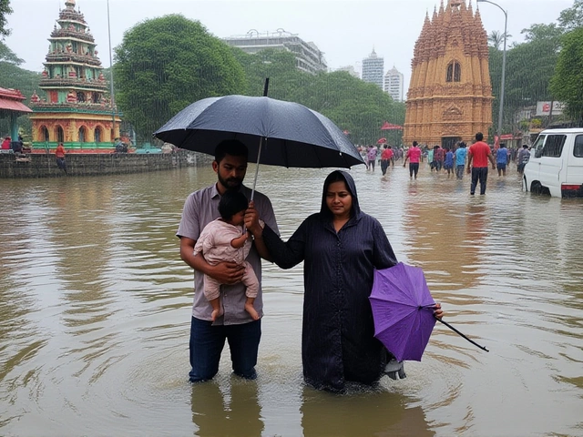
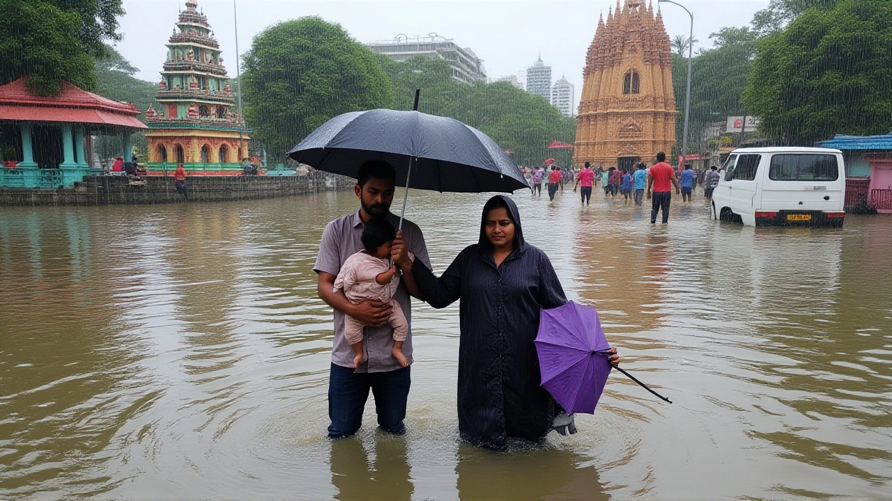
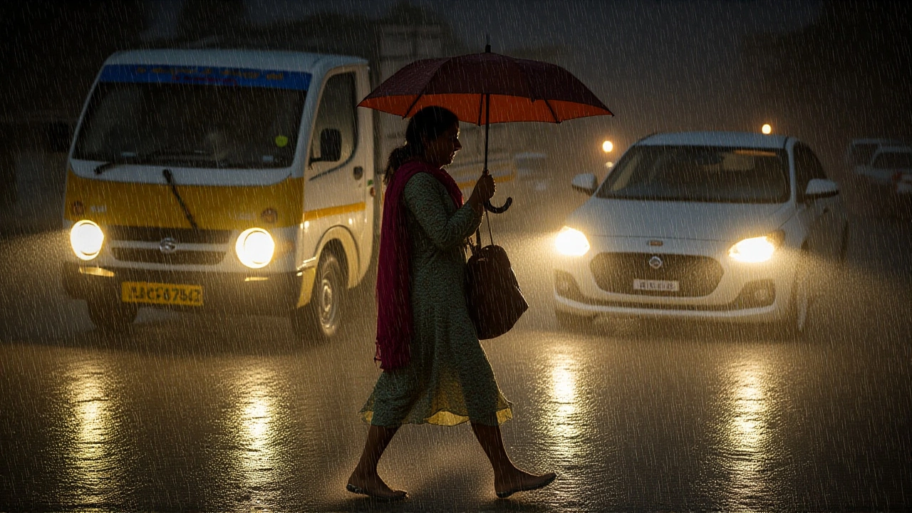
Impact on Chennai: Floods, Traffic, and Daily Life
Chennai has already been wrestling with water‑logging for several days. The city’s drainage network, strained by rapid urban growth, is struggling to keep pace.
Local resident Meena Kumar described the scene: “Water reached my doorstep within an hour of the first downpour. Buses are stuck, and the market lanes are turned into streams.” Officials from the Greater Chennai Corporation have dispatched additional pumps and announced temporary road closures on the Inner Ring Road.
Beyond inconvenience, there are safety concerns. Lightening strikes have been recorded, and authorities urge people in low‑lying neighborhoods to avoid water‑logged zones and keep emergency kits ready.
Responses from Authorities and Experts
The India Meteorological Department (IMD) reiterated that orange alerts signal a need for heightened preparedness. In a statement, the department’s headquarters in New Delhi, operating under the Ministry of Earth Sciences, pledged support to state disaster management teams.
State officials have activated emergency response teams in the most vulnerable districts. In Thanjavur, the district collector announced that temporary shelters are ready for up to 2,000 evacuees, while in Ramanathapuram the police have stationed volunteers at key bridge crossings.
Weather analyst Ramesh Iyer of the private consultancy WeatherNow cautioned that “even after the system moves away, the saturated ground will keep rivers running high, so secondary flooding could occur on Oct 25‑27.”
Looking Ahead: What Comes After Oct 24?
By the end of the alert period, the low‑pressure system is expected to weaken as it enters the open Bay of Bengal, but the residual moisture may linger. Meteorologists predict a modest temperature dip of 2‑3 °C across inland Tamil Nadu, offering a brief respite before the post‑monsoon dry spell sets in.
Residents are advised to stay tuned to daily bulletins from the RMC and to follow local municipal updates. As the monsoon season pushes toward its annual climax, the next few weeks will test the region’s flood‑management capacity.
Frequently Asked Questions
How will the orange alert affect daily commuters in Chennai?
Roads in low‑lying suburbs are likely to be inundated, leading to delays of 30‑60 minutes on major arteries. The city corporation has rerouted some bus services and advised commuters to use alternate routes or public transport where possible.
What safety measures should residents in flood‑prone districts take?
Keep sandbags and emergency kits ready, avoid walking through standing water, and stay informed via SMS alerts from the RMC. If evacuation orders are issued, move to designated shelters immediately.
Why is the northeast monsoon so crucial for Tamil Nadu’s water resources?
The northeast monsoon delivers about 48 % of the state’s annual rainfall – roughly 45 cm – and accounts for 63 % of Chennai’s yearly total. These rains replenish reservoirs, support agriculture, and replenish groundwater, making them vital despite the flooding risk.
What’s the difference between an orange and a red weather alert?
An orange alert signals heavy to very heavy rain (6 cm‑20 cm in 24 hrs) with potential flooding, while a red alert indicates extreme rainfall (over 20 cm) and imminent danger of life‑threatening floods or landslides.
When is the next forecast update expected?
The RMC releases updates every six hours during active alerts. The next bulletin is scheduled for 1800 hrs IST on October 22, with subsequent releases at 0000 hrs and 0600 hrs.